
Huge iceberg breaking up off South Georgia Island is still a threat
What effects on wildlife and the ecosystem the icebergs will have are unknown.
What was the largest iceberg on Earth is threatening to come to a halt soon in a pristine Antarctic wildlife sanctuary that’s home to penguins, seals, and a small population of endangered blue whales.
The iceberg, labeled A68, broke off from the Larsen C ice shelf on the east coast of the Antarctic Peninsula in 2017. It had been slowly inching north until this year, when an ocean current quickly propelled it into the Southern Atlantic Ocean. (Find out about how climate change is melting the Antarctic Peninsula.)
About 95 miles long and 30 miles wide at its widest point, the iceberg covers an area of roughly 1,500 square miles and extends 500 to 600 feet underwater. Satellite images show it is shaped like a closed hand with an index finger pointing forward.
Scientists expect the iceberg, currently about 31 miles from South Georgia, to either anchor in the shallow waters around the island or move past it in the coming days. Should it come to a halt, it’s also unclear how long the iceberg might stay intact and in place.
“There’s always a chance it could shoot up north, or it could get grounded where it is for a period of time,” says Chris Readinger, the Antarctic lead analyst at the U.S. National Ice Center. “It looks like the highest probability is it would drift south of the island.”
Recent images, he says, show the iceberg is beginning to break apart, and scientists are eagerly watching to see what it does next.


“We don’t have that much scientific information for icebergs like this,” says Geraint Tarling, an ecologist for the British Antarctic Survey. He describes A68’s genesis as a natural event, but says given the warming climate, particularly in the region that spawned the berg, it could be “a taste of things to come.”
Timeline of A68
The Antarctic Peninsula is one of the fastest warming regions on Earth, and the ice shelves along its eastern coast are breaking apart. The Larsen A ice shelf, near the northern tip of the peninsula, collapsed in 1995; its neighbor to the south, Larsen B, was caught on spectacular satellite images as it followed suit in 2002.
The Larsen C is the next ice shelf in line and by far the largest of the three. A large, deep crack appeared in 2010 and continued to grow until July 2017, when it broke off. The A68 iceberg was born—a chunk of ice the size of Delaware with a mass of about 10 percent of the shelf itself.
For most of 2017, the berg didn’t move much. But in 2018 it began drifting north and rotated several times, according to tracking records from Brigham Young University. Throughout 2019, it wandered north through Antarctica’s Weddell Sea until it was caught in the strong Antarctic Circumpolar Current, a counterclockwise ocean current that circles the continent.
Icebergs the size of A68 are so massive and extend so deeply into the sea that it often takes a sizable current to propel it forward. Throughout 2020, A68 chugged north and east, zigging and zagging and rotating occasionally—but advancing steadily closer to South Georgia.
“It probably can’t get any closer,” says Readinger. “The ocean there is about 500 feet deep and the berg is about there [in depth].”
The iceberg could screech to a halt on the shallow underwater shelf that surrounds the island and not collide with dry land. Readinger notes that it’s in warmer waters than can sustain it and it’s likely already beginning to break apart.
“There are little tiny bergs about a mile long spinning off of it,”” says Readinger. “I wouldn’t be surprised if a large piece breaks off and we name it A68d.”
Chunks of A68 have broken off in the past three years, named A68b and A68c.
“It’s getting very close to grounding, which means it will hit the underwater shelf. If it does that, it will get stuck, or it will rotate around,” says David Long, director of the center for remote sensing at Brigham Young University, a lab that tracks iceberg movements. Long says it may hit “pointy end first,” which could cause it to break apart more quickly, and ocean currents could force the rest of the iceberg to pirouette north past South Georgia. He expects it to rotate around to the east before continuing north.
A taste of what’s to come?
Ice shelves like the Larsen C are the floating ends of glaciers on land. As the glacier flows out to sea, icebergs calve off the ocean-facing end of the ice shelf. In a world that isn’t warming, these natural processes can be in balance. The Larsen C has existed for at least 10,000 years.
Its collapse at the hand of global warming was first predicted more than 40 years ago—but that doesn’t mean global warming launched A68. “When you try to say something about climate change, you can’t say it about one event,” says Kelly Brunt, a geophysicist from the University of Maryland. “Climate change is a statistical game.”
But is it likely to send more icebergs toward South Georgia in the future?
About 90 percent of the icebergs that break off from all of Antarctica travel counterclockwise around the continent, hugging the coast, into the Weddell Sea; from there they drift north toward South Georgia, through a region that’s dubbed “iceberg alley.”


In 2002, Long tracked every berg he could identify from 1978 to the present. The result was an exponential increase in the number of them, seemingly an indication of climate change. But by tracing icebergs to their points of origin, he found that the increase he measured may have been part of a natural cycle of ice shelf growth and decay. So while it couldn’t be blamed on warming in the region with the data they had at the time, “It did not rule out that warming was contributing,” he says.
When the A68 calved from Larsen C in 2017, the British Antarctic Survey reached similar conclusions, saying climate change may have played a role, but the ice shelf’s natural life cycle was also a factor.
The collapse of Larsen B in 2002, however, demonstrated how a warming atmosphere can help bring that life cycle to a sudden end. Meltwater ponds formed on the surface of Larsen B, and water percolating down through the ice helped shatter the shelf into an armada of icebergs.
More recent work Long has done with scientists at the National Snow and Ice Data Center suggest that the ice shelves remaining on the Antarctic Peninsula may be very vulnerable to that “hydrofracture” mechanism. Based on that, Long says, “We could expect more icebergs as warming continues.”
How many will make it as far as South Georgia is another matter. Even if icebergs do become more common in the region, country-size ones like A68 may remain rare. Since the 1970s, Readinger says the number of such giants in iceberg alley hasn’t measurably increased or decreased.
And smaller bergs tend to break apart before reaching the area around South Georgia.


“They have to be pretty big to get all the way [to South Georgia],” says Long. “It’s hard to know whether there will be an increase.”
A threat to wildlife
For now, A68 poses a large threat to the region’s wildlife and marine biodiversity.
Large icebergs with deep keels “scour the seabeds,” explains Tarling. “What’s really important about South Georgia is that it’s incredibly diverse on the seabeds. It’s a diversity almost equivalent to the Galapagos.”
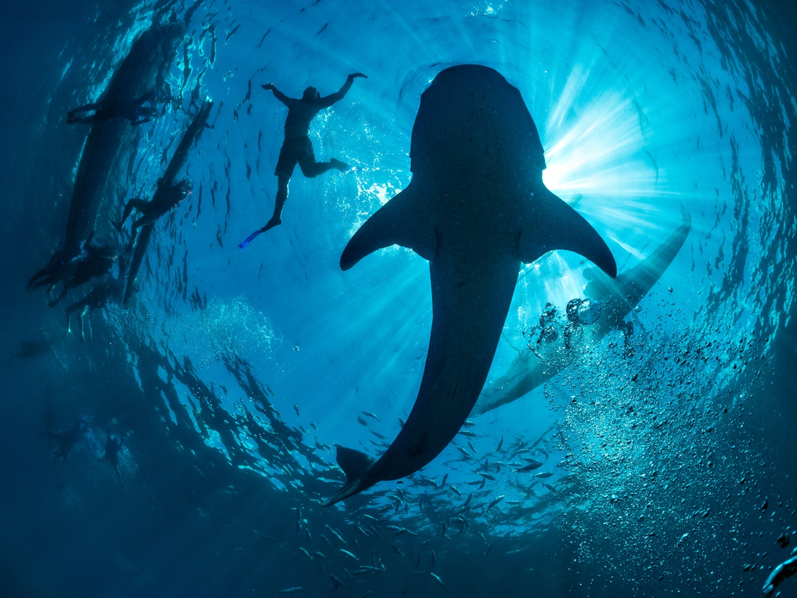
On the seabeds surrounding South Georgia, scientists have found abundant communities of brittle stars, urchins, worms, and sponges. They’re also home to an abundance of fish and Antarctic krill, an essential part of a food chain that feeds seals, penguins, and a number of whale species.
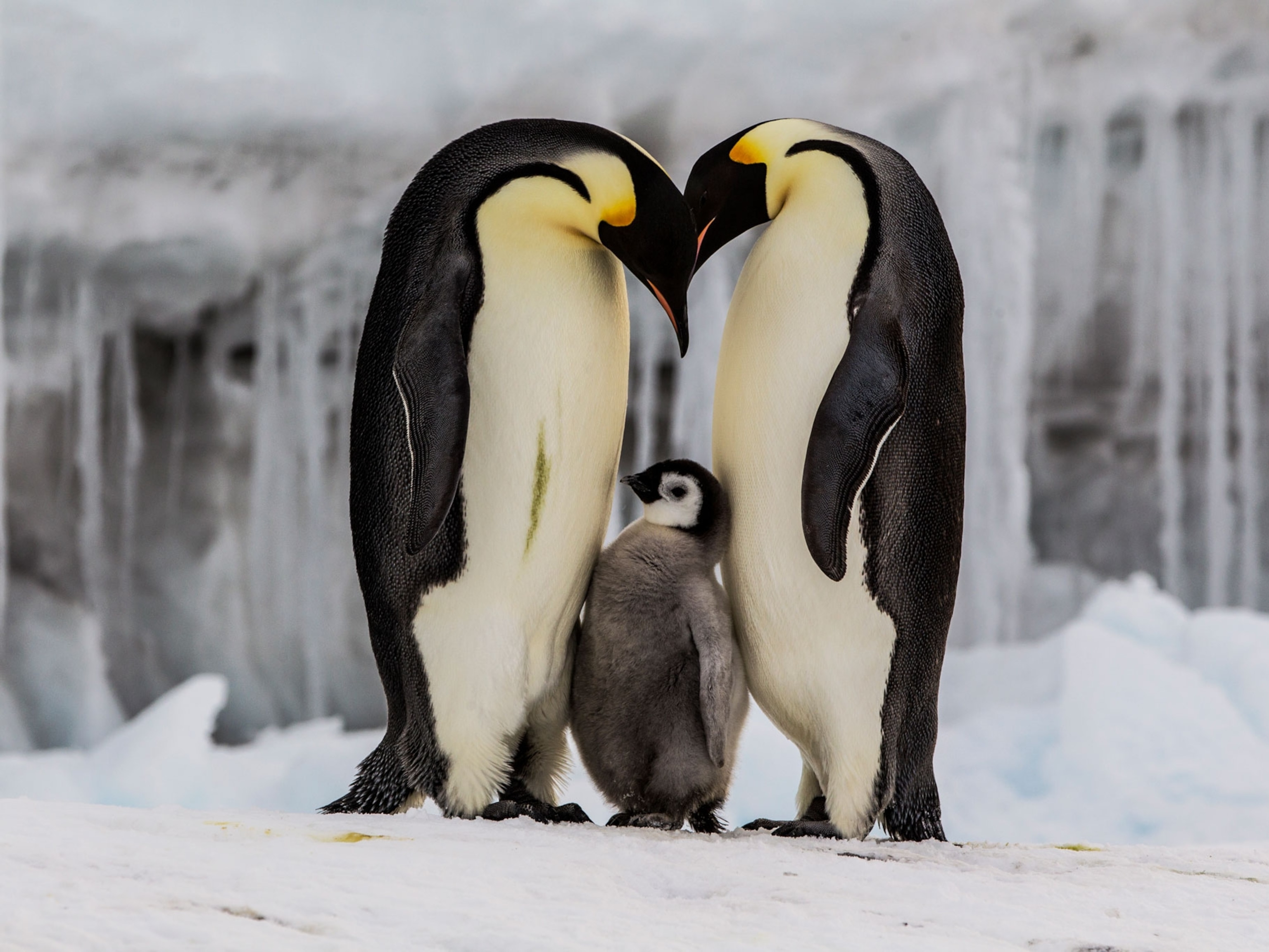
The region’s charismatic penguins and seals will also suffer if the iceberg grounds in place, because it would create a wall between land and their feeding grounds at the edge of the coastal shelf.
“It’s a really important time in the life cycle when the adults are bringing up chicks and pups and need to make small, frequent journeys out to feeding areas,” says Tarling.
He notes that even if the iceberg breaks apart, the resulting fleet of little bergs could still block the animals’ foraging paths.
A68, which contains hundreds of millions of tons of freshwater, will ultimately melt, making living conditions harder for creatures such as algae and plankton that have adapted to living in saltwater.
In late January, a team of scientists led by the British Antarctic Survey will depart from the Falkland Islands to the iceberg to study its effects on the ecosystem. The information will be crucial to understanding how the ecosystem will change if warming results in more icebergs in the future.
Related Topics
You May Also Like


Go Further
Animals
- This fungus turns cicadas into zombies who procreate—then dieThis fungus turns cicadas into zombies who procreate—then die
- How can we protect grizzlies from their biggest threat—trains?How can we protect grizzlies from their biggest threat—trains?
- This ‘saber-toothed’ salmon wasn’t quite what we thoughtThis ‘saber-toothed’ salmon wasn’t quite what we thought
- Why this rhino-zebra friendship makes perfect senseWhy this rhino-zebra friendship makes perfect sense
Environment
- Your favorite foods may not taste the same in the future. Here's why.Your favorite foods may not taste the same in the future. Here's why.
- Are the Great Lakes the key to solving America’s emissions conundrum?Are the Great Lakes the key to solving America’s emissions conundrum?
- The world’s historic sites face climate change. Can Petra lead the way?The world’s historic sites face climate change. Can Petra lead the way?
- This pristine piece of the Amazon shows nature’s resilienceThis pristine piece of the Amazon shows nature’s resilience
- 30 years of climate change transformed into haunting music30 years of climate change transformed into haunting music
History & Culture
- When treasure hunters find artifacts, who gets to keep them?When treasure hunters find artifacts, who gets to keep them?
- Meet the original members of the tortured poets departmentMeet the original members of the tortured poets department
- When America's first ladies brought séances to the White HouseWhen America's first ladies brought séances to the White House
- Gambling is everywhere now. When is that a problem?Gambling is everywhere now. When is that a problem?
Science
- Quieting your mind to meditate can be hard. Here’s how sound can help.Quieting your mind to meditate can be hard. Here’s how sound can help.
- Should you be concerned about bird flu in your milk?Should you be concerned about bird flu in your milk?
- Here's how astronomers found one of the rarest phenomenons in spaceHere's how astronomers found one of the rarest phenomenons in space
- Not an extrovert or introvert? There’s a word for that.Not an extrovert or introvert? There’s a word for that.
Travel
- Photo story: a water-borne adventure into fragile AntarcticaPhoto story: a water-borne adventure into fragile Antarctica
- Germany's iconic castle has been renovated. Here's how to see itGermany's iconic castle has been renovated. Here's how to see it
- This tomb diver was among the first to swim beneath a pyramidThis tomb diver was among the first to swim beneath a pyramid
- Food writer Dina Macki on Omani cuisine and Zanzibari flavoursFood writer Dina Macki on Omani cuisine and Zanzibari flavours
